Labels

Hiking (31) Hiker Buddies (7) Tips (7) Challenging Hikes (6) Family Friendly (6) Rouge Park (6) Ten Things (6) Durham (5) Advice (4) Meetup (4) Pickering (4) Food (3) Ontario (3) Toronto (3) Bruce Trail (2) Flora (2) Gear (2) Montreal (2) Poison Ivy (2) Quebec (2) Snacks (2) Whitevale (2) carriers (2) Volunteering (1) farms (1) markets (1)
Showing posts with label Challenging Hikes. Show all posts

Monday, 22 October 2012

Oh Bruce! Oh Carlita!

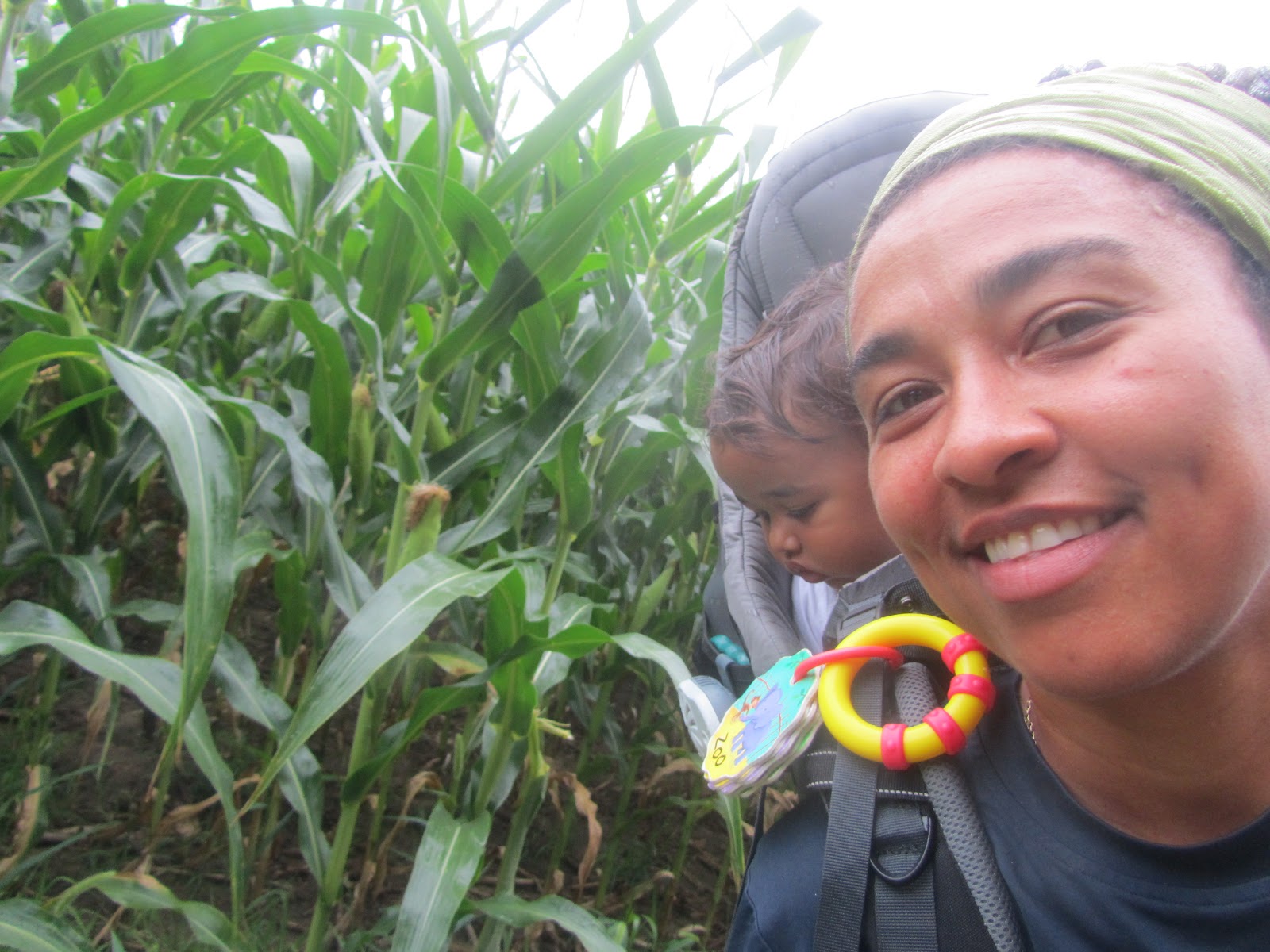
This is a bit about my second time hiking on the Bruce Trail.  My hiker buddy this round was my sis, Carlita!  She's a trooper, if ever I met one. 

The 401 bridge at the Toronto and Iroquois
 border of the Bruce Trail
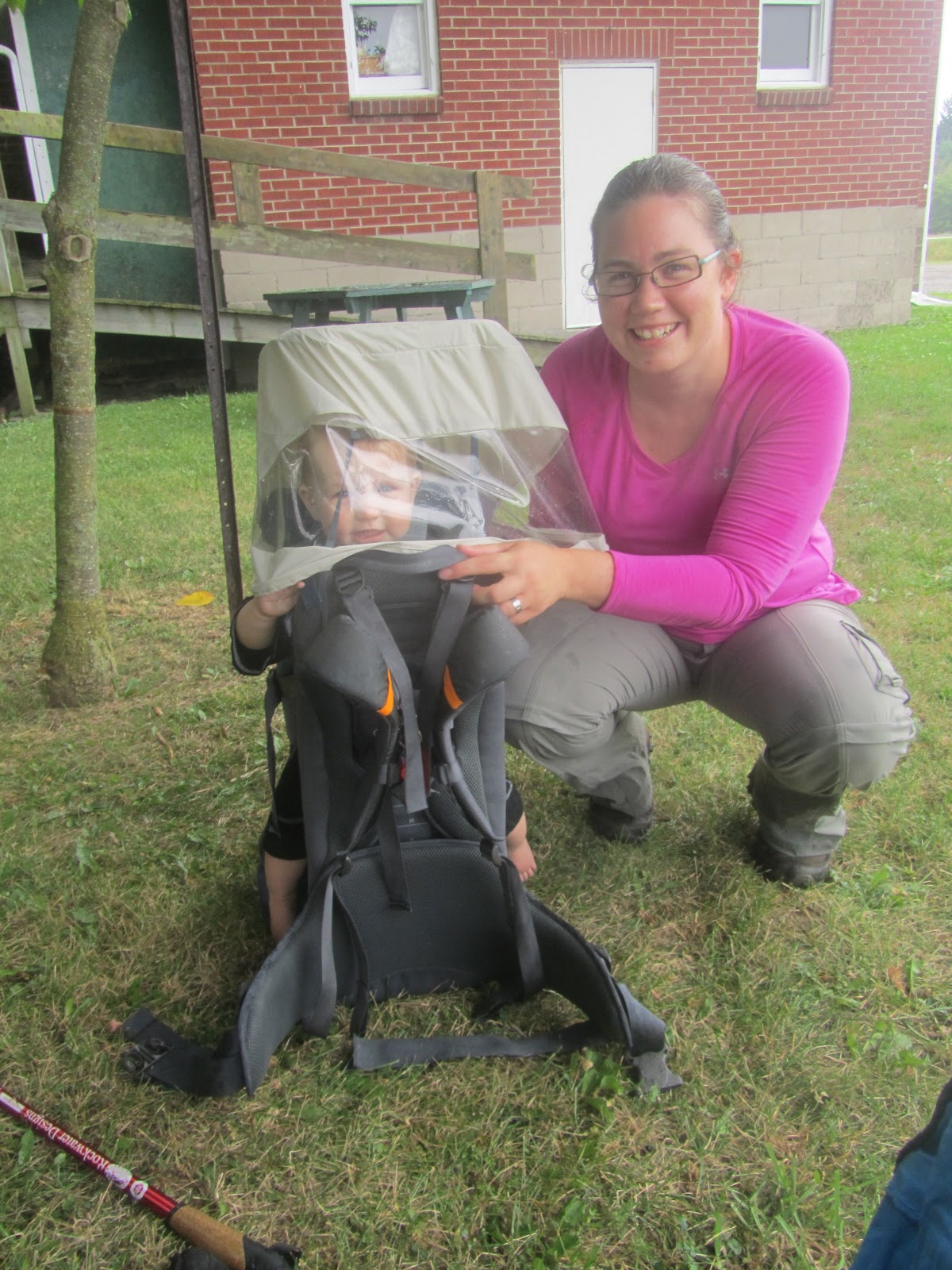
Waking up L'il Chica on Sunday morning at 6:30 was not an easy task.  She had a tough night (waking up for a good hour at 3 o'clock in the a.m. ever since we started with day-care).  She slept through the wake-up and car drive to pick up my sister about 30 minutes away.  All well so far.  Once we were on our way to our hiking spot, we were in high spirits.  L'il Chica was happily having her breakfast bottle and the 401 was traffic-free (even on a Sunday a.m., one never knows).  The drive toward the Niagara Escarpment was a treat -- the fall colours were brilliant and we could see the hills upon which we would soon hike.

Hopping the fence!  Oh, what fun!
We parked at the Kelso Conservation Area and set out on our planned 15-km hike.  With blood pumping through our veins and with a good 40 lbs on my back, we reached our first hurdle -- a ladder!  In fact, it would be one of four ladders.  How in tarnation was I supposed to balance my way over a ladder with a stacked carrier?  And, why was there a ladder there in the first place?  The answer is that the Bruce Trail crosses into fenced private property from time to time -- chicken and barbed wire fence at that.  Unless one breaks down the fence, the only option is to climb over it.  Thank goodness for that ladder -- I guess I wouldn't want to fall on a barbed wire fence.  Ouch!

Onward to Hilton Falls!
Chatting with my sis in the fresh fall morning air was good fun -- she's in good shape.  A gym junkie who also jogs, she likes a physical challenge.  The whole 'footing' thing was the only real adjustment -- she now has a new respect for hiker and trail runners. 

Our hike crossed from the Toronto section and into the Iroquois section of the Bruce Trail.  The first 6 km northbound went up to and along the escarpment -- lots of slippery limestone covered in moss and leaves.  Footing alert!  No slips yet, though.  Once we got to the Dufferein Quarry Bridge (what a view!), we turned back as we still had a good 9 km to go.  Heading south now, L'il Chica was still doing well -- she was having fun stretching her arms trying to touch the nearby trees.  Soon enough, she'll get sleepy -- as is usually the case with infants, movement, and fresh air.  My plan was to get us to Hilton Falls and give L'il Chica a walking break -- a bit of a stretch for her in the carrier, but all was going well so far.  We were looking forward to one of the many waterfalls we had heard of on the Bruce Trail.  Forward march!

The hike plan, highlighted in yellow.  Please ignore any green smudges -- L'il Chica's artwork.


By the time we were at 9 km, we were feeling the aches.  My hamstring was tightening up, and Carlita was starting to doubt 'this whole hiking thing'.  Yah, it's pretty and all, but why does it have to take forever to get to anywhere?!  A passerby wearing Bruce Trail gear told us we were not far off from Hilton Falls.  So the map said, too.  Why was it taking forever, then?  By the time another walker said to us, "It's just up there.  You're not far at all."  we were reenergized!  Picking up the pace, we listened for the sound of rushing water.  But, where was it?  We kept going, listening for water ... 'not far at all' echoing in my head.  When we got there ... finally... we saw the most... how to put it?  The most ... hmm... the most disappointing sight ever.  A waterfall?  A fall?  Where was it?  There was no water, far less falling water.  There was, though, a hole in the ground -- a big 'maco' hole in the ground... but THAT was all!  It turns out that Hilton Falls USED to be a cascade of sorts thousands of years ago.  What is left behind is a very interesting natural formation in the limestone shield.  A perfectly cylindrical hole in the terra firma... But, no water.  Oh dear!  Oh Carlita!  Sorry about the anti-climactic hike to Hilton FALLS... smh. (All caps are intended -- we were pooped and near exasperation by this point.)
The hole in the wall of limestone... aka Hilton Falls.
The last 5 km were tough.  We fought to keep spirits high, despite the lovely weather and awesome temperature -- 17 degrees C.  At one point, head low, almost unable to look up at the trail ahead, I commented to myself, 'Hey!  At least my pants look clean.  Not even on smudge of dirt.  Good on ya, Marie!'  There was at least one happy note in my exhaustion.  But wait!  Too soon!  I slipped on a small but slippery slope, startling L'il Chica to an outburst.  No worries, though, up again and with no bruises, we trudged along to the parking lot at Kelso.


You call THAT a waterfall!? LOL!

Legs aching, back at the car, and the skies still blue, how should I look upon this 4.5-hr-long Bruce hike?  As a disappointment? Naaah!  I got to hike with my sister -- yay!  I accomplished a good 15-km-plus hike in really good time -- BONUS!  L'il Chica was a trooper as usual -- can't beat that at all.  Amazing weather, fall colours in all their glory, great chatting with my sis, L'il Chica learning the word for 'tree' in French, and, of course, take two for Bruce.  Nothing to complain about, and more Bruce to come.


Oh! And, a bonus today (the morning after) was my sister's text: "... this morning went to the gym now walking like an orangutan lol i would love to do another hike hook me up". Oh Carlita!

Saturday, 6 October 2012

Happy Thanksgiving Hike


Sunny Skies were on the bill that morning.
This was the hike I was waiting for since last month.  A good 4-hr hike on the Seaton Trail was just what I needed to brush away the blues.   A recent stint of ‘mid-section expansion’ ... why don’t we call it ‘bloating’ ... had added to my back-to-work blues, and I was just dying to head out on a long trek.

L’il Chica and I set off with high spirits from Clarke’s Hollow just after nine in the morning. We had some snacks, some water, and lots of energy. The skies were blue, and the air was cool and fresh. What could go wrong?

After about an hour – passing by a few happy dog walkers, some with off-leash dogs (grr) – we arrived at the playground in Whitevale.That went well –for about 20 minutes L’il Chica enjoyed the swing, slides and some snacks.


Backwards down the slide.  Wheee!


Note the face: the remants of
a near-meltdown before leaving the playground
Getting her back into the carrier was not as much fun.There was an almost-meltdown, but we set out north to Green River anyway. Evidence is in the photo to on the right.  
 
As we walked, her mood turned for the better and we chatted away ... she mimicking what I said as we identified trees, birds, leaves, squirrels and the blue, blue sky.  She’s lots of fun now that she’s so vocal.  One of her favourite words to say is “bow-wow” whenever she sees a dog.  It actually sounds more like “rawr-rawr”.  But, then again, dogs do not actually say the sound of the letter “B” in ‘bow-wow’, do they?
The turn-around at Green River

Within 10 minutes, she was asleep in the carrier.  So, once we made it to Green River, I did not bother to take a lunch break.  That would have just awoken her, and who needs that when you’ve already got well-enough going for you.  At the half-way point at about 11:30, 7.5 km from the start point and with a good 30 lbs on my back, I turned around to enjoy a quiet walk back. 

Outdoor café in Whitevale


She was up again by the time we got back to Whitevale, so we stopped there for her leg-stretch.  This time, we skipped the park and chose to rest at a little outdoor café where a local woman sells coffee, soup and fries to passers-by.  It’s a cute little spot in the pretty little hamlet.  I really like these neat things about Whitevale.

By the time we made it back to Clarke’s Hollow, I was bushed and my right foot was a little achy.  L’il Chica was happy to be out of the carrier (only to be put into the car within 10 minutes).   As I write now, my foot is still a bit sore, but I’ll take that anytime if I get it from a hike like today’s hike. 

So, what could go wrong on my hike today?  Not much at all.  There’s way too much to be thankful for, and a little sore foot is likely a blessing in disguise.  What an awesome start to the weekend!
Happy Thanksgiving!


Wednesday, 22 August 2012

Meeting up with Bruce


Meeting up with Bruce
I’ve always wanted to hike along the renowned Bruce Trail that stretches a over 800 km from Tobermory to Niagara.  The most daunting part of hiking the Bruce Trail is not the hike itself but that getting to the trail would mean driving across town on the busiest stretch of highway in Canada – the Toronto stretch of the 401 – and trying to avert traffic.  My hiker buddy and I left our homes east of the city at 9:00 a.m., after rush hour, to arrive west of the city at the Rattlesnake Conservation area at 10:00 a.m.  This would leave us about 4.5 hrs of hiking time before the homeward bound rush hour started.  Planning a hike around Toronto rush hour is not fun.

From Rattlesnake Conservation Area we decided to hike to Crawford Lake Conservation Area – the Bruce Trail runs through many conservation areas in this part of town.  This would mean a 14.4 km return hike in some moderate to difficult terrain.  Not bad for 2 mommas with 20-lb toddlers on their backs.


Breathtaking Views of the Canyon form the top of the Escarpment
Take the Blue Trail!
On the first leg, things were easy enough.  Nice fresh legs following the blue markers to the lake.  We met a woman along the way who seemed to know her way around, so we clarified that we were going the right way.  She took one look at our babes on board and assured us that we should not hike the blue – “Follow the orange trail. The blue is going to be too tough with those babies on your backs.”  Hah!  We both gave two internal scoffs at that vote of non-confidence and decided that when we saw the orange trail, we would ignore it.  We needed no more encouragement than someone else's doubt as our extra challenge.  Not too far on we came across the first main intersection ... hmm... blue or orange?  We took the blue.  It was well worth it.  What breathtaking views we got at the lookout points.  The blue trail followed the edge of the escarpment (which we had to climb) so we got great views into the Nassagaweya Canyon -- well worth the detour. 
                                                                                                                                                                                         
Hiker Buddy and L'il O at the Lunch Spot
L'il Chica and Hiker Marie at the Lunch Spot
The whole thing, though, about not following instructions, it that the road to the finish line is not as one might have planned. As we trudged along with high spirits, we realized that our maps stopped making sense. We were well off the planned trail and the blazes did not help much. Confused as we were, we ended up hiking an extra 3.5 km and delaying our arrival to Crawford Lake for a lovely lakeside lunch. In fact, we never did make it to the lake and ended up only at the Crawford Lake visitors centre. We lunched instead along the trail where there are benches built into a boardwalk that crosses Limestone Creek.


At the Visitor Centre before the 7 km walk back to Rattlesnake


Not to worry though, we will return to the trail in the fall when the view into the canyon is a mix of brilliant oranges, yellows and gold.  Keep your eyes peeled for the next meeting with Bruce.


Thursday, 9 August 2012

In the Rain with a Hiker Buddy


The weather forecast could have left us hopeless – rain all day.  Booooo!!!  But, we went out anyways.  After a few minutes on trail, I realized that all would be well.  We had come prepared, after all.  Onward along the Seaton Trail for a 16 km hike with rain gear in tow.
On the first leg near the corn fields.  There is hardly a drizzle.


It had been some time since I had seen my hiker buddy, Katy, so I was excited to meet up.  As it turned out, she could not join us at the start at the Forestream Rd trailhead, because her little Paige had to complete her beauty rest. (Aaah... the mystery of a baby who loves to sleep in.  My L’il Chica sleeps no later than 6:55 a.m.  Up and at 'em.  Want to play, Ma?).   We had to hike a good 6 km before we met up at the Whitevale trail head, so we kept a good pace.


Once we met up with Katy, we got to chatting about everything from her camping vacation, the Olympics (the whole Canadian Women’s Football drama), family, and, one of our favourite topics while killing calories, food! Home-made Mac & Cheese and wild blueberries topped the list.

After about 3 km we were at Green River and Highway 7 where we chilled for a bit at the community centre. Up to this point the drizzle had been light and we were well-sheltered under an ash tree. On the menu was PBJ sandwiches, peaches, water and bananas for L’il Chica and me. Katy and Paige’s spread included wild blueberries (thankfully they shared with us). Yummy :o) If you ever get a chance to sample wild blueberries (they are smaller and tastier than the store variety) take advantage of it. The extra cost is worth it.


L'il Chica and Paige taking a break from their carriers
Rain Cover for the Vaude Carrier
Rain Cover for the Deuter Carrier


By now, the drizzle was steadier, and we had to pull out the rain covers for the carriers.  First time for me... woo hoo!  We headed back south toward Whitevale with high spirits and lots of energy.  The girls were also happy despite the drizzly weather.  We hung out a bit at Whitevale to chat some more and to give Paige a stretch before the car ride home.  Sadly, L’il Chica and I had to say goodbye as we still had an hour or so to get back to where we parked at Forestream.  See you soon, Katy and Paige!
See you soon, Katy and Paige!


Alright, then. Still 6 km to go, all by our lonesomes. Wait! That would be ‘my’ lonesome. L’il Chica has fallen asleep within a few minutes – the inevitable on a long hike. The walk back is at times tough on my legs as I am getting tired, the hills on this southern part of the trail grow increasingly tougher, and L’il Chica is getting heavier as she grows. But, silence is golden, and the pitter-patter of the rain on the leaves make me forget my wet shoes and pants. 


I am Tired and Slouching on the Last Leg
 
Hmm... I'm also getting hungry. What's for lunch?
Home-made Mac & Cheese!  Thanks for a great morning, Katy and Paige.


Meetup for a 10-15 km Walk


When we get together with my Meetup group for long hikes, we always have a good time.  Hiking with friends means chatting, catching up, and finding out something or the other about baby care.  it also means lots of laughs.  Last week we got together for a 15 km walk in Rouge Park.  It seemed like a lot at the start, but by the end, we realized that time just flew by.

The first leg was southbound for 2 km from the Pearse House along the Vista Trail.  This was a good way to rev up the engines as it was mostly flat and downhill.  Hah!  Easy peasy!


Heading back on the 3rd leg of the hike
Lots of ups and downs on the Mast Trail


The second leg was on the connecting Mast Trail just across Twyn Rivers Drive.  This was where we pumped up the jam a bit as there was a relatively steep climb up to the ridge.  With our legs burning and with the loads of children in carriers, it was a super workout.  But, what goes up must come down.  It felt good to head down the hill towards the river.  Once we were at our southern-most point at the Glen Rouge Camping area, we turned back and headed north along the Mast for a return trip of almost 6 km.  Again, what goes down must go up.  We retraced our steps back up the ridge.

For the third leg we continued north along the connecting Orchard Trail for just over 2 km.  Once we had made our last steep climb (pros by this point), we ended up at the Beare Wetlands where we had a refresher, fed the 3 youths, and chilled for a bit.  After a half-hr or so, we were recharged enough to press on.  Woo hah!  5 more kilometres to go!  And, to think we had the option to end the hike by returning to Pearse House where the cars were parked.
Rest Stop after 10 km and Recharging for the Final 5 km

For the fourth leg, we went past the wetlands and continued north on the Cedar Trail.  As we approached the northern trail head at Meadowvale Rd, there was quite a drama near the river.  Some sort of raptor squawking at the top of its lungs.  As hard as we tried, we could not spot it.  Oh well... time to turn back.

We finally headed south for a total of 5 km+ on the Cedar Trail.  What a great workout!  The fresh air, thighs-a-burning, happy babies (well... almost) and happy hikers!

If you want to know more about the Meetup group, check it out at http://www.meetup.com/Pickering-Parents-Hiking-Group/


Monday, 7 May 2012

Ten Things -- Why I Love the 'Seaton Trail'

The Seaton Trail is located in Pickering and follows the West Duffins Creek. It runs about 13 km from 3rd Concession near Brock Road in Pickering to Highway 7 at Green River.  There are a few trail entry points, but my favourite is at Whitevale in North Pickering.  Not only is it close to my home, but there are a few picnic tables, a shelter, a playground with swings and all, and even a field for soccer and such. 


Today's Hike

Today we walked with our hiker-buddy and her little girl.  We went from the Forestream entry point to Whitevale.  Although the weather was cloudy and the forecast threatened rain, it made for a great hiking experience -- no sunburn and no overheating.  There and back was about 9 km in all.
Checking out Duffins Creek from the Seaton Trail

Ten Reasons to Hike the Seaton Trail (between Whitevale and Clarkes Hollow)

1.  Good challenge for avid day hikers and trail runners. There are many hills in this portion. My calves ache even as I write this.  Find out more about the Seaton Trail at http://www.seatontrail.org/ .
2.  Family-friendly play area at Whitevale -- This area is maintained by the City of Pickering.  There is usually a portable toilet, but there are also picnic tables, benches, a swing set, a playing field, parking lot, and a good view of the creek.  This was a good rest area (see below) on my hike with Hiker Katy.  I can see this as an awesome picnic spot for us in the years to come.
3.  Super views of Duffins Creek from hill and river levels -- I even saw a turkey vulture the other day hanging out on a fallen tree overhanging the creek.  The bluffs created from erosion (booo!) provide dramatic vistas (yaaay!).
4.  Much less foot traffic compared to the other more popular trails in the region, so you are often alone in your serenity
5.  Plentiful flora -- fields of trillium, may apple, wild ginger, bloodroot and other native plants.  It it good that the Seaton Trail flora is respected and that there are few signs of foraging or of invasives.
6.  Many shady spots -- good deciduous and evergreen mix to provide shade and sun when you need it.  Only a couple meadows that are upland from the river.
7.  Multiple entry points -- Whitevale and Forestream/Clarkes Hollow are a couple. Check the map for more on that: http://www.seatontrail.org/maps/
8.  Location -- not too far from Toronto and just a few km from the 401.  Yet, you really have a sense that you are in a wilderness area.
9.  Many resting points on logs -- if you are interested in resting. Hah!  The TRCA is in very often managing the trails for step and bridge maintenance.  There is also a good management of fallen trees, so there are many dotting the sides of the trail.
10.  Ample parking at all entry points for this section of the trail.  Don't forget to carpool if you are expecting a large group.
Chilling with Hiker Katy before the return walk to Forestream Rd.

If you hike on the Seaton Trail,
or if you have questions about hiking on the trail,
 feel free to ask.